Coordinated Fire and Rescue Helicopter and Drone Operations in Trøndelag, Norway
- Aug 8, 2025
- 2 min read

Credit: Trøndelag fire and rescue on drone operation
What you need to know: |
|
The problem with invisible Drones for emergency services
In Midt-Norge (Central Norway), the Fire emergency dispatch center coordinates fire and rescue services for all 40 municipalities. In the Trøndelag region, as part of their regional drone preparedness, a shared fleet of DJI drones is in operation, staffed by a team of 10 certified pilots.
These drones can be requested for emergency missions across the region, supporting search and rescue, wildfire surveillance, flood monitoring, and more.
This lack of visibility between helicopters, manned aviation and the drones made coordination difficult and introduced real safety risks, especially during high-stakes emergency missions.
Sverre Hogstad, Chief Pilot for the Trøndelag region said:
"A key priority for us is airspace safety. We often operate in parallel with manned aircraft, including Norwegian Air Ambulance and the Royal Norwegian Air Force’s SAR helicopters. This makes it essential that our drones are visible in the same systems used by helicopter crews. "
How was it solved?
The turning point came when SafeSky became compatible with the Dronetag Mini. With this integration, the Trøndelag team found a solution that was affordable, effective and easy to deploy.
Once attached to the drone, the Dronetag Mini begins broadcasting position using both RemoteID for compliance and SafeSky network for situation awareness with other airspace users.
Operated drones can now legitimately be seen by manned aviation: SAR and HEMS helicopters can continue to use their existing onboard Apps, such as SafeSky App or Air Navigation Pro.
General aviation and recreational pilots, such as paragliders, paramotors and utlra-lights; can also see the drones from any of the 30+ compatible systems.
And in return, the Trøndelag team operators get to see other manned traffic while operating their drones.

Example on Air Navigation Pro used by HEMS Helicopters
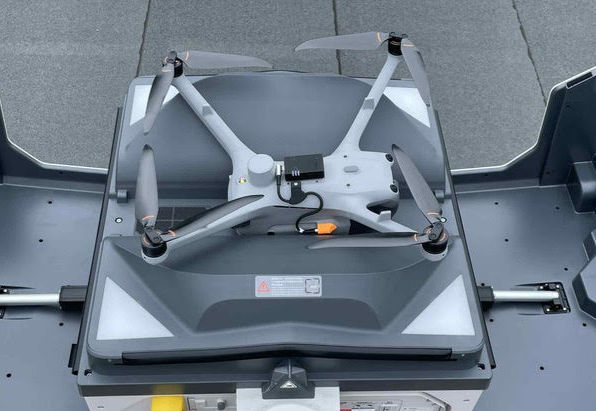
The Dronetag Mini on a DJI drone.
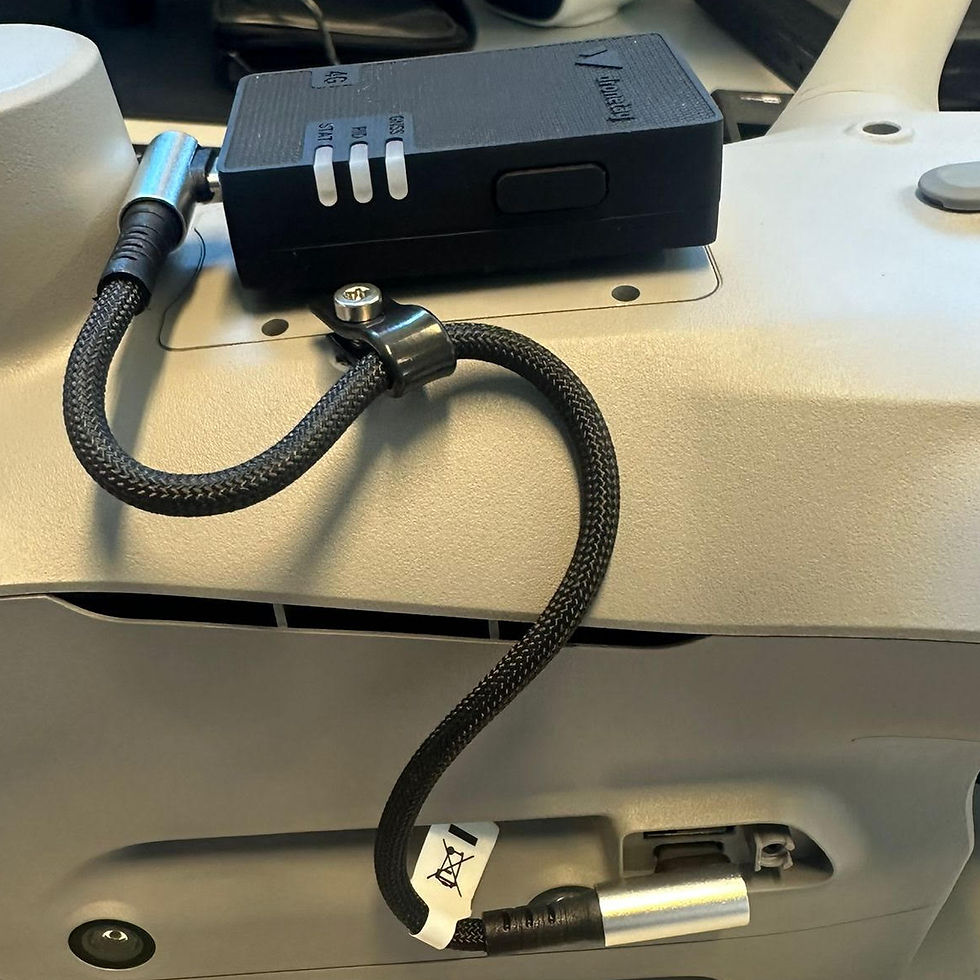
A USB cable ensures
automatic activation on takeoff.
Sverre Hogstad, Chief Pilot for the Trøndelag region explained:
"SafeSky has been on our radar for some time, and it finally offered the solution we were looking for. Thanks to SafeSky’s integration into HemsWX and Air Navigation Pro, our drones are now visible in the tools used by emergency helicopters."

SAR Queen helicopters operating across Norway.
Credits: 330 squadron - Search and Rescue🇳🇴.
Want to learn more about our collaboration with Dronetag ? Read the article here.


