Aviant and SafeSky: Pioneering Safe Drone Operations under EASA SORA 2.5 SAIL III
- Nov 5, 2025
- 3 min read

What you need to know: |
|
Meet Aviant!
Aviant is a Norwegian technology company building an autonomous logistics network using drones. Its mission is to enable faster, more sustainable deliveries through on-demand, long-range drone transport. The company provides a complete end-to-end system, from aircraft design and autonomous flight software to ground infrastructure and operational control.
After thousands of successful commercial flights and the launch of their consumer delivery service Kyte in Norway and Sweden, Aviant is now transitioning from operating in sparsely populated zones (< 500 people/km²) to suburban and low-density metropolitan areas (< 5 000 people/km²) south of Oslo. This shift enables Aviant to serve more people from a single base, boosting efficiency and impact. But it also introduces a need for stronger safety oversight and compliance.
To achieve this, Aviant is applying for an Operational Authorisation to conduct operations assessed via EASA SORA v2.5 at SAIL III , and leveraging SafeSky as a key part of their risk-mitigation strategy.
The SafeSky platform plays a critical role in helping us maintain safety and compliance while scaling our services.
— Stian W. Helgesen, Flight Operations Manager, Aviant
Drone Safety Framework
Aviant’s suburban expansion falls under EASA’s Specific Operations Risk Assessment (SORA 2.5) for “Specific” category UAS operations. Their goal is to reduce initial risk level 6 to a residual 3, corresponding to SAIL III.
Ground-Risk Mitigation: Handled through route planning, altitude control, and a medium-classification parachute system to minimise ground-impact risk.
Air-Risk Mitigation: More complex, requiring clearly defined operational and adjacent volumes, publication via NOTAM or Danger Area (geozones planned later), and live mitigations through situational-awareness traffic data.
Aviant’s initial ARC-c has been successfully mitigated to ARC-b, supported by real-time traffic data, electronic conspicuity, and SafeSky integration.

How SafeSky Enhances Aviant’s Safety and Compliance
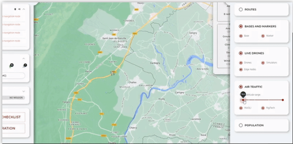
1 - Real-Time Bi-Directional Traffic Data Exchange
Through SafeSky’s API and Network ID, Aviant integrates live manned- and unmanned-aircraft data directly into its operations centre. In return, its drones broadcast their own positions back into the SafeSky network.
This bi-directional exchange not only satisfies SORA 2.5 tactical-mitigation requirements but also bridges the gap between traditional aviation and autonomous drone operations, giving both communities real-time mutual awareness.
2 - MultiTracker Ground Stations and Operational Resilience
Aviant has deployed several ground stations equipped with Multitracker Avionix systems, serving as both traffic-awareness tools and backup systems in case a drone loses network connectivity or the LTE provider fails.
Each Multitracker continuously feeds traffic-awareness data into Aviant’s Operational Control Centre (OCC), the Avionix Aero-Network, and the SafeSky network, ensuring uninterrupted visibility and coordination across all operational layers.

3 - Heatmaps and Airspace Intelligence
Aviant currently uses Avinor commercial traffic data to produce quarterly heatmaps that identify areas of concentrated aviation activity and seasonal flight-pattern variations.
In the future, SafeSky will complement this with multi-source data from 30 + traffic feeds, covering paragliders, gliders, paramotors, ultralights, trikes, general aviation, and other drone operators, providing a truly comprehensive picture of low-altitude airspace activity.

Why This Matters?
1 - For Drone Operators
Transitioning into suburban or low-density metropolitan zones requires not just regulatory approval but live, actionable awareness. SafeSky’s integration helps operators like Aviant go beyond compliance, delivering continuous situational awareness and a proven air-risk-reduction layer for SORA 2.5 SAIL III.
2 - For Manned Aviation Pilots
With Aviant’s data now shared through SafeSky, pilots can see drones operating nearby in real time, improving coordination and reducing mid-air-collision risk in shared airspace.

“SafeSky’s bi-directional traffic exchange expands our situational awareness and lets us scale into suburban Oslo safely and responsibly.”
— Herman Øie Kolden, CTO & Co-Founder, Aviant
Ready to Expand Safely?
Whether you’re preparing for new operational authorisations or scaling your drone activities, SafeSky helps you integrate real-time traffic data, heatmap intelligence, and network-based air-risk mitigation to support compliance and enhance safety under EASA SORA v2.5.
“With Aviant, we’re showing how multi-source traffic and live data sharing make integrated airspace practical today, not just on paper.”
— Tristan Fily, CEO, SafeSky